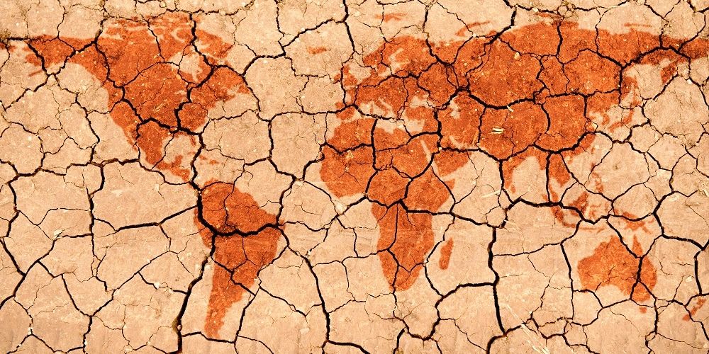
Between 2005 and 2014, disasters have caused total damage of US$1.4 trillion worldwide, with 1.7 billion people affected and 0.7 million killed [1]. With climate change, urbanization, environmental degradation and poverty, the world has been experiencing disasters at a higher frequency and intensity. To be effective, disaster management strategy must be able to meet the health needs of the affected population. With non-communicable diseases (NCDs) now being the major disease burden and leading causes of death worldwide, the traditional health focus of humanitarian response on acute conditions is no longer sufficient to address population health needs in disaster and emergency context. The significance of NCDs management and planning for potential humanitarian context must be recognized.
You are here
出版物 & 研究
出版物 & 研究
我們為研究人員、災難管理人員、醫護人員及學生,提供一個專業交流、合作及政策討論的平台

出版物 & 研究
香港賽馬會災難防護應變教研中心的出版物涵蓋了教研中心跟合作夥伴、顯赫學術機構的研究項目,以及有關災難防護和應變的其他研究與開發。
指引列出了教研中心特別揀選的災難管理技術資訊、操作指引和有用工具。
博客提供了一個平台,讓持份者能分享與災難有關的最新動態、意見及經驗分享。
博客文章由作者以個人身份或代表所屬單位撰寫。內容表達的觀點、思維及意見純屬作者個人想法,並不代表香港賽馬會災難防護應變教研中心的立場。
公眾可在尊重知識產權情況下,使用所有資料,並必須適當引述出處。
2017
19/09/2017
Between 2005 and 2014, disasters have caused total damage of US$1.4 trillion worldwide, with 1.7 billion people affected and 0.7 million killed [1]. With climate change, urbanization, environmental degradation and poverty, the world has been experiencing disasters at a higher frequency and intensity. To be effective, disaster management strategy must be able to meet the health needs of the affected population. With non-communicable diseases (NCDs) now being the major disease burden and leading causes of death worldwide, the traditional health focus of humanitarian response on acute conditions is no longer sufficient to address population health needs in disaster and emergency context. The significance of NCDs management and planning for potential humanitarian context must be recognized.
14/07/2017
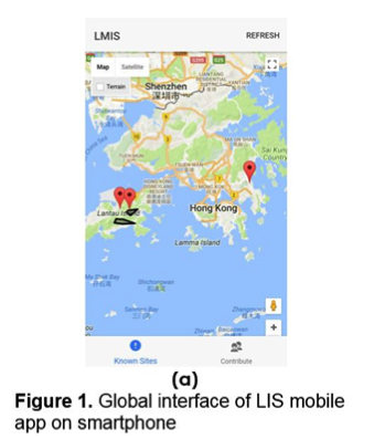
A prototype mobile App for the Landslide Information System (LIS)
The Hong Kong Jockey Club Disaster Preparedness and Response Institute (HKJCDPRI) Research Grant 2016 was awarded to the Hong Kong University of Science and Technology (HKUST). The research aims at developing a new smart Landslide Information System (LIS) that can improve the planning of access and evacuation routes for emergency responders during intense rainstorms. Furthermore, the LIS aims to provide easily accessible real-time landslide information to the public and to enhance landslide incident reporting in Hong Kong via smart technology.
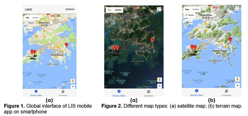
The HKUST Research Team has characterised relationships between landslide failure mechanisms and rainfall. Landslide hazard mapping was adopted to verify correlations between rainfall and landslide occurrence. The hazard map will be incorporated into the LIS mobile App which is currently under development (see Figs. 1 and 2 below for snapshots of the mobile App). It is envisioned that the final product will display and disseminate real-time landslide information, provide emergency routing information to emergency responders and identify high-risk landslide areas with the application of the landslide susceptibility model.
Later in October 2017, the HKUST Research Team will attend an international geotechnical conference in Canada (GEO Ottawa 2017) to share their research findings on the LIS mobile application.
This research demonstrates how innovative smart technology can be used as an early warning system and play a major role in reducing risk associated with landslides. More findings and progress on this research will be shared in the coming half year.
For more information, please contact us at [email protected] or (852) 2871 8507.

Prof. Clarence Choi, in-charge of the research project.
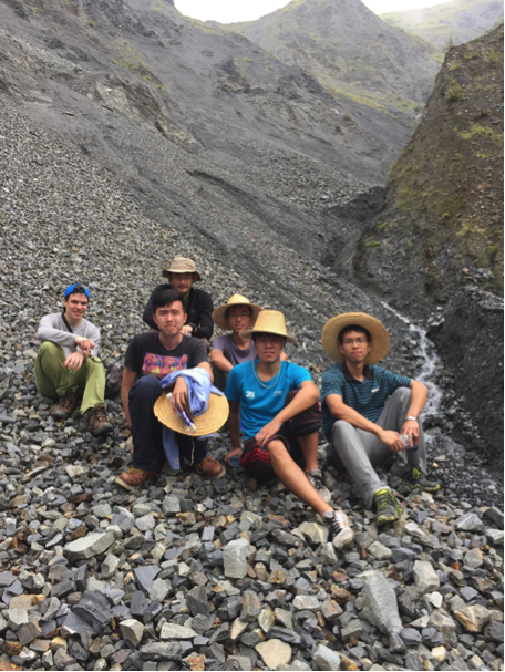
HKUST Research Team (left to right)
Back: Mr. George Goodwin (PhD Student); Prof Clarence Choi; Mr. Haiming Liu (PhD Student)
Front: Mr. Luis Liu (PhD Student); Mr. Desmond Cheung (PhD Student); Mr. Chao Wang (PhD Student)
14/07/2017
Aiming at providing accessible real-time landslide information to the public and leverage smart technology to enhance landslide incident reporting in Hong Kong, the Hong Kong University of Science and Technology is developing a new smart Landslide Information System (LIS), which will be supported by the Hong Kong Jockey Club Disaster Preparedness and Response Institute Research Grant 2016.
The research team consisted of three prominent scholars including Prof Clarence Choi, Research Assistant Professor from the Department of Civil and Environmental Engineering (Principal Investigator), Prof Qian Zhang, Chair Professor from the Department of Computer Science and Engineering and Prof Charles Ng, Chair Professor from the Department of Civil and Environmental Engineering.
It is hoped that the development of the system will improve planning of access and evacuation routes for emergency responders during intense storms when transportation lines are obstructed by landslides, enhance characterisation of landslide failure mechanism to better inform and protect emergency responders and the public of areas susceptible to landslide failures. The system also intends to enrich landslide incident database, in terms of scale, responsiveness, and communication of information to geotechnical engineers during intense storms.
For more information, please contact us at [email protected] or at (852) 2871 8507.
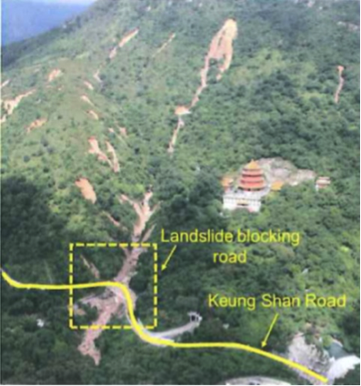
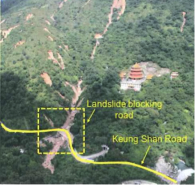
Keung Shan Road landslides, Tai O, Hong Kong, 2008
28/04/2017
Early warning systems are critical to protecting populations from harm during disasters. The recent Sendai Framework for Disaster Risk Reduction highlights a need to increase the availability of and access to early warning systems as a priority target.1 A number of nations, including Hong Kong, have already established highly developed early warning systems. However, the changing landscape of communication technologies has created both opportunities and challenges for people as they navigate a greater number of information networks, and a higher frequency of messaging.
Early warning systems are critical to protecting populations from harm during disasters. The recent Sendai Framework for Disaster Risk Reduction highlights a need to increase the availability of and access to early warning systems as a priority target.1 A number of nations, including Hong Kong, have already established highly developed early warning systems. However, the changing landscape of communication technologies has created both opportunities and challenges for people as they navigate a greater number of information networks, and a higher frequency of messaging.